
 Buy ticket


Accessibility
To Plätzwiese high plateau
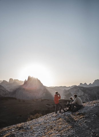
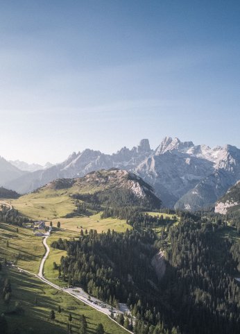
The Plätzwiese is a high plateau at an altitude of 2,000 meters, with overwhelming panoramic views of the nearby mountains Dürrenstein peak and Hohe Gaisl peak and from there to the more distant peaks of Monte Cristallo peak and Tofane peaks. On the Plätzwiese high plateau visitors experience nature and peace. Not least because of its inclusion in the Nature Park Fanes-Sennes-Prags this jewel, surrounded by majestic peaks, has retained its unspoilt nature.


Info about the Plätzwiese high plateau toll road:
From 06.06.2026 to 08.11.2026, access to Plätzwiese high plateau is only possible by paying a toll.
Access is possible for a maximum of 100 cars & the following regulations apply:
- 06.062026 - 30.06.2026 and 16.09.2026 - 08.11.2026:
- Until 10 a.m. and from 3 p.m.
- 01.07.2026 - 15.09.2026:
- Until 9 a.m. and from 4 p.m.
- From Brückele/Ponticello: until 10 a.m. - 3 p.m.
Departure is permitted at any time.
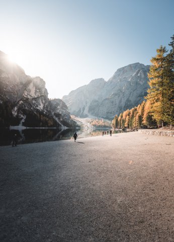
Info about the Pragser Tal valley:
From 01.07. to 15.09.2026, access to the Pragser Tal valley between 9:00 a.m. and 4:00 p.m. is only permitted by public transportation, on foot, by bicycle or upon presentation of an online reservation or a valid transit permit.


Pragser Tal valley
This is who we are
The combination ticket
Straight to Plätzwiese high plateau
All good things come in threes: With the €44 combination ticket, you'll get a transit permit, a parking space, and €22 back as a voucher to spend at our restaurants and shops.
It pays to book in advance: The €22 voucher is available only for advance bookings, not for same-day bookings.
Private arrival
44 €
One ticket many benefits
- Transit permit
- Parking space
- Bus (if necessary)
- *22€ back as gourmet voucher for selected restaurants and shops
*except for bookings for the same day
Ticket booking
Traffic regulation from 01.07. - 15.09.2026
Check Availability
Tickets available
Car
44 €
For all vehicles lower than < 2.20 m
- Transit permit
- Parking space
- Bus (if necessary)
- 22€ back gourmet voucher for restaurants and shops
Camper
49 €
For all vehicles that are higher than > 2.20 m
- Transit permit
- Parking space
- Bus (if necessary)
- 22€ back gourmet voucher for restaurants and shops

FAQs
What you should know
Information on the general traffic regulations
The traffic regulations in the Pragser Tal valley are valid from 01.07.2026 to 15.09.2026.
From 01.07.2026 to 15.09.2026, special traffic regulations apply in the Pragsertal valley. During this period, the valley is only accessible from 9 a.m. to 4 p.m. by public transport, on foot, by bike or with a valid online reservation or a transit permit. Tickets for the reservation can be booked from mid-June.
From 06.06.2026 to 08.11.2026, access to Plätzwiese high plateau is only possible by paying a toll.
Access is possible for a maximum of 100 cars & the following regulations apply:
- 06.062026 - 30.06.2026 and 16.09.2026 - 08.11.2026:
- Until 10 a.m. and from 3 p.m.
- 01.07.2026 - 15.09.2026:
- Until 9 a.m. and from 4 p.m.
Departure is permitted at any time
The traffic regulations apply to cars, motorcycles, coaches and motorhomes.
From 01.07. to 15.09.2026 the Pragser Tal valley can only be reached between 9 a.m. and 4 p.m. by public transportation, on foot, by bicycle or on presentation of an online - reservation or a valid transit permit.
The ticket can be booked and paid for directly online here.
During the period in which the traffic regulations apply, you can pass through the Pragser Tal valley with a transit permit (issued by the accommodation facility).
You can leave the valley at any time.
The traffic situation and the associated traffic jams were no longer bearable for the valley and the residents.
The Pragser Tal valley is one of the most popular excursion destinations in the summer months. In order to guarantee safety and security, access to the Pragser Tal valley has been restricted. In this way, the number of visitors is automatically reduced and the guests can be offered more freedom and a safer experience.
This also contributes to the protection of the sensitive ecosystem of the Dolomites UNESCO World Heritage.
Yes, with a disabled pass you can go to Plätzwiese high plateau at any time. It is sufficient to show the pass at the checkpoint at the entrance to the valley.
A reduced access fee applies for cars with a disabled pass.
On the Plätzwiese high plateau there is a wide forest path with only a few meters of elevation gain.
Arrival with your own car, motorhome, coach and motorbike
When the traffic regulations are in effect, the Pragser Tal valley can only be reached with presentation of an online reservation or a valid transit permit. The parking space in Brückele/Ponticello can be booked. It is located 6km before Plätzwiese high plateau. The 443 bus to Plätzwiese high plateau is included in the price.
No, this parking space is not bookable. You can reach it before 9 a.m. or after 4 p.m. You have to pay the fee of 10,00€ at the tollbooth. This car park has 100 spaces. When they are full, the road will be closed at the tollbooth.
The tickets can be booked and paid for online here.
Paid parking spaces are available at the Pragser Wildsee lake, in the village of Säge and at the Brückele parking space.
Attention: Parking spaces are limited, chargeable and must be booked.
The same regulations apply as for all other cars.
Motorbikes can book a parking space, the so-called combination ticket, for the same price as cars. You will not receive a discount. The ticket can be booked and paid for online here.
No, there is a year-round ban on coaches passing through. The coach can reach the Brückele car park before 9 a.m. or after 4 p.m. Guests can then hike up or use the bus 443.
There is a year-round ban on the passage of private buses and motor homes (campers). Campers can access the P5 Brückele car park before 9 a.m. and after 4 p.m. However, there are limited parking spaces. It is recommended to change to public transport.
The license plate number can be given provisionally. To change the license plate number before arrival, please contact the Tourist Info Prags and the change will be made. E-mail: info@pragsertal.info, telephone number: +39 0474 748 660
Transit permits are issued by the respective company for guests of restaurants, shops and other service providers in the Pragser Tal valley. Please contact the relevant company directly.
Arrival by public transport
Bus 443 runs every hour from Toblach and Welsberg to Plätzwiese high plateau. Online reservation and online payment is NOT required.
Bus 443 (direction Plätzwiese high plateau) can also be used during the traffic regulation with the guest cards.
Yes, the südtirolmobil Pass is valid for the bus 443
Yes, Mobilcards can be used on bus 443 to Plätzwiese high plateau.
The buses depart from Toblach and Welsberg.
The buses to Plätzwiese high plateau run every hour (except lunch break).
You can find all information about the bus departures and schedules here.
Bus 439 stops at the following stops: Untergasse, Edelweiss-Erika, Hofstatt, Säge, Schmieden-School, Schmieden-Church, Bodner, Waidach, St. Veit-Church, St. Veit-Oberhaus and Pragser Wildsee lake.
Bus 442 stops at the following stops: Untergasse, Edelweiss-Erika, Hofstatt, Säge, Schmieden-School, Schmieden-Church, Bodner, Waidach, St. Veit-Church, St. Veit-Oberhaus and Pragser Wildsee lake.
Bus 443 stops at the following stops: Untergasse, Edelweiss-Erika, Hofstatt, Säge, Schmieden-School, Schmieden-Church, Hauser, Altprags, Brückele and Plätzwiese.
Unfortunately, it can happen that buses are delayed or cancelled due to traffic jams or a breakdown. In such cases, we kindly ask for your understanding and patience. You can use the next bus.
No, bicycles cannot be taken along.
Yes, pets are allowed. They must also have a ticket. Dogs must wear a muzzle on all public transportation, including buses.
You can find information about this here.
Yes, the bus stops are barrier-free.
Arrival by bicycle
The Plätzwiese high plateau can be reached by bike at any time. No restrictions apply.
A cycle path leads from Welsberg to Schmieden. From Schmieden, the trail continues on forest path number 37.
Yes, there is bicycle parking (not lockable) near the huts. We would like to point out that the bicycle parking spaces are limited.
It is not allowed to take a bike on public transport such as busses. You can take them on the train though.
Arrival on foot
No, a reservation is not required for walking. The Plätzwiese high plateau can be visited on foot anytime.
To find out, click on the modal "hike" at the top of the landing page.
For the return journey with the bus, you need a ticket. This can be made on the bus. ATTENTION: Payment on board is only possible in cash!
Information on the combination ticket (arrival with your own car and motorbike)
With early booking (up to one day before)
1. Guaranteed parking space
2. Transit permit
3. Bus (if necessary)
4. 22€ voucher in one of the participating establishment
Combination tickets can be booked for those arriving by car, motorhome or motorbike.
The combination ticket costs 44€.
The combination ticket is valid for the public car parks P1, P2 and P5 (Brückele/Ponticello) and for a limited amount of the spaces at P3.
For those arriving by car or motorcycle, only the so-called “combination tickets” will be offered at the public parking lots (P1, P2 and P5). A parking space reservation alone is not possible.
With a pre-booking, you not only secure your transit permit and a guaranteed parking space worth 44€, but also an exclusive voucher in one of our regional restaurants and shops worth 22€.
The combination ticket can also be booked on the day of arrival. Remaining spaces, which are booked on the day of arrival, cost 44€ and do not contain a voucher.
In the first step you decide on a parking lot and in the second step you are asked to select the company where you would like to redeem the voucher.
The voucher must be redeemed on the day of arrival.
When booking, you have the option of selecting the company, but only as long as the contingent lasts. If the company is fully booked, you must choose another company.
The general conditions apply according to the GTC.
If parking spaces are getting free on the same day, they can be booked later. The price remains at 44€, but a voucher is no longer included for a company.
Online reservation and payment
You need an online reservation if you arrive by car, motorbike, rental car, motorhome or the public bus. You also need a reservation if you arrive with bus lines 439 and 442.
You can book the combination ticket for your car or motorhome for 44€.
Online tickets can only be paid for using online payment systems and credit cards. Cash is not accepted.
The general conditions apply according to the GTC.
Rebooking is possible up to three days in advance at the Tourist Info Prags. Otherwise, please contact the Tourist Info Prags, who will do their best to rebook your ticket subject to availability.
You will receive the ticket by email.
The ticket must be presented for inspection, either digitally or in paper form.
In the case of payment problems, please contact the Tourist Info Prags.
Make sure your details are correct. Check your SPAM. Otherwise, please contact the Tourist Info Prags.
No, you cannot.
If there is space on the next bus, the ticket can be rebooked at the Tourist Info Prags.
Children up to the age of 6 travel for free.
There are no discounts for seniors or groups.
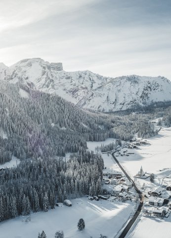
General information winter
The cross - country trail on Plätzwiese high plateau is closed now. You can find all information on the cross coutry slopes here.
You can find all information about the winter hiking trails here.
You can find the currently open huts here.
It snows from the beginning of December. However, it can also start snowing earlier if temperatures are low.